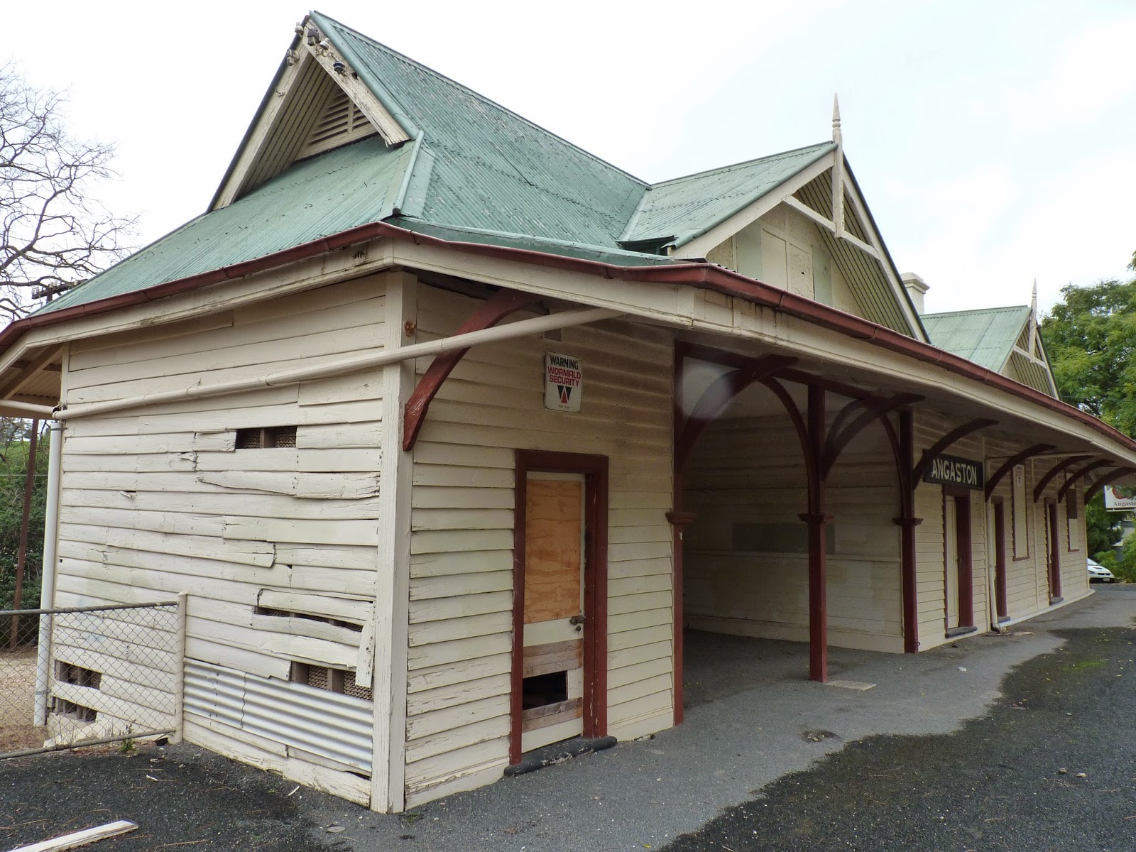
On a trip this weekend to the Barossa Valley, I took some photos around the disused Angaston Railway Station.
Angaston was the end of the line from Gawler Central Station (terminus of the Adelaide Metro) into the Barossa Valley. This stopped being used for passenger services many years ago, with the Barossa Wine Train the last regular train to serve passengers on the line. Subsequently some occasional National Rail Museum charter train journeys were the last train trips on the line.
There is some talk of the Barossa Wine Train service coming back, with the original Barossa Wine Train recently tested and discussions apparently in progress - I hope so - I would love to ride it!
There is a branch line from this line still open and active to the Penrice Soda facility near Angaston. , operated by a train called the "Stonie" by locals, transporting soda products from the quarry to Penrice's facility in Port Adelaide for processing.
The railway line split to Penrice occurs just after Nuriootpa railway station, with one section going to Angaston and the other to Penrice.
The Nuriootpa to Angaston line has recently been converted into a cycle way, replacing the old railway line completely making any future restoration of services along this section much more difficult.
However, at Angaston station (as shown below) a short section of the old railway line has been retained, along with the turntable section for turning trains around (not maintained well) and the sections that used to lead to storage sheds I suspect (although not certain of this previous use).
Below is the view looking towards Angaston Railway Station, with the Goods Shed on the right, and the Angaston Station platform on the left (you can click to expand any of these photos for a closer look):
Here is the view towards Nuriootpa, showing the bicycle path which has now replaced the main railway line between Angaston and Nuriootpa. Below you can see where the short track left now ends, where it used to merge into the main railway line towards Nuriootpa:
The Goods Shed is preserved well enough, and is still on the Angaston Railway station site today in 2014. Here is a view of the Goods Shed from the platform:
Another view of the Goods Shed from ground level, looking towards Nuriootpa:
The Angaston Station building itself is starting to show the sure signs of lack of maintenance and care. Here is the view of the Entrance side of the building from the car park:
The ticket office:
Platform side view of the station building:
View from the other side of the building. You see the timber has seen better days:
Passenger waiting area:
View of the station building platform side from the former railway line bed (now a cycle lane):
I noticed that the platform edge has started falling apart in sections like below, and it is not particularly safe:
Here is a view of the platform edge damage I observed from the railway line bed, looking towards the platform:
Here is the view past the platform at the Angaston end of the station platform showing the line splitting off to the turntable and continuing to the final end. The cycle path on the right winds up to street level just out of shot:
A close up of the in situ switch:
Next to the line leaving the good shed is this statue of a man reading a newspaper, waiting for a train that will never come...next to him some lock ups for bicycle riders while they explore Angaston:
The turntable at Angaston, clearly not maintained anymore and becoming a bit of an eyesore, overgrown and becoming a dumping ground for rubbish:
A car park was made over the in situ railway lines that continue past the turntable. You can still see the rails clearly in the car park:
Here is the view from the car park back towards Angaston Railway Station:
Here marks the end of the main line - almost:
Beyond the end sign above, the tracks continue into the bush land behind:
And past the bushes this is where the line actually ends. Beyond this point is a hill rising to the road crossing:
There is an information sign that explains a little about the history of the railways in the area, installed as part of the bikeway installation on the former railway line (click to expand):
With the conversion to bikeway, it means some ongoing work will be done to keep the railway station area clean into the future for that purpose. Whether any attention is made to keep the railway station building or turntable clean and tidy remains to be seen.